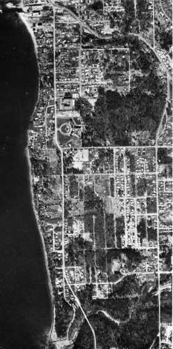
Historic Aerial View of the Zenith Neighborhood
Photograph description
A vertical aerial photograph shows the Zenith neighborhood, road network, shoreline, and Saltwater State Park area.
- Date or period
- After Saltwater State Park was established in the 1920s; exact photograph date not established.
- Place
- Zenith neighborhood and Saltwater State Park, Des Moines, Washington
- People
- No people are individually identifiable.
Historical context
DMHS identifies 16th Avenue South and Kent-Des Moines Road as orientation points and Saltwater State Park near the lower portion of the image. A separate DMHS page says the park was presented in 1926 and dedicated in 1933.
Research note: The legacy orientation text mentions the mouth of McSorley Creek twice in different positions; the revised description avoids repeating that ambiguity until map/photo orientation is catalog-checked.
Research references
Historical identifications are stated only where supported by the existing DMHS collection or corroborating research. Unresolved dates, names, and locations are identified as such rather than inferred from appearance alone.